Hwy 101 mile marker 235b.
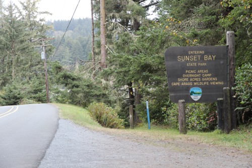
Sunset Bay is the second of five beaches, parks, and viewpoints
on the "Charleston Loop".
To reach the Charleston Loop:
A few blocks after you cross the bridge leading into North Bend, highway 101
splits into two separate one-way streets. Soon after this you will come to Virginia Ave. There is a sign indicating a right turn for "Charleston - State Parks".
"Don't turn here".
It's easier to pass up this right turn and turn instead on Newmark street a few blocks further south. Newmark's street sign also has a separate sign
labeled "High School - Community College". Turn right onto Newmark.
It will soon become "Cape Arago Highway". Continue driving toward
the bay. Just before the bay, Cape Arago Highway turns left.
This highway is the "Charleston Loop". Note that further down,
Cape Arago Highway turns right and you will immediately cross a bridge and enter Charleston.
Continue on Cape Arago Highway
to the five recreation areas.
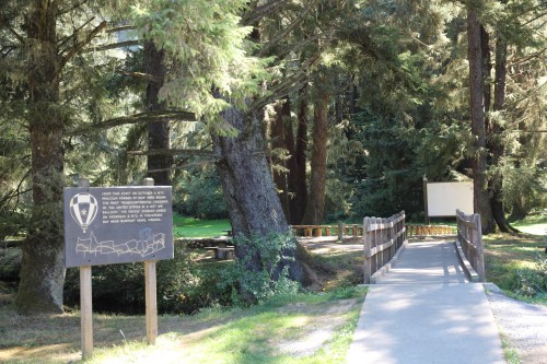
Note that there is a trail which connects Sunset Bay, Bastendorff Beach, Simpson Reef, Shore Acres, and Cape Arago.
This trail runs along the Cape Arago Highway, with numerous excursions into forested areas and near the beaches
Site Resources: camping area, RV area, yurts, picnic tables, restroom, showers. A golf course is adjacent.
Oregon state parks link:Sunset Bay No fee required to visit the beach.
Entrance on Charleston Loop |
Sign at trail entrance (commemorates transcontinental balloon trip) |
 |
 |
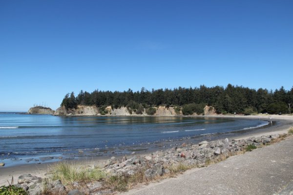
View to the North |
You are looking here at the South side of Gregory Point, with Chief's Island at the tip. Hidden from view is the Cape Arago Lighthouse.
You can take a somewhat distant picture of it from a trail that runs between Sunset Bay State Park and Bastendorff Beach. |
 |
|
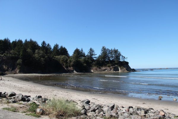
A view toward the South. You can see a cave at the end of the peninsula. |
View to the South |
 |
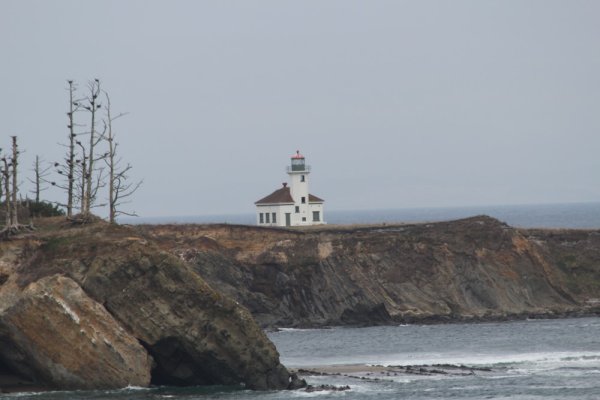
The Cape Arago Lighthouse |
Here is a zoomed-in picture of the somewhat elusive Cape Arago Lighthouse. Note that there is a "Cape Arago State Park" on the Charleston Loop. It's at the end of the Cape Arago Highway. Note however that the Cape Arago Lighthouse itself is between Sunset Bay and Bastendorff Beach. |
 |
Copyright © 2014 J.A.